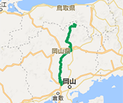
NIHONKAI・SETOUCHI ROUTE
This long-distance route straddles the border between Tottori and Okayama Prefectures, and features a rich variety of tourist spots throughout the year, including beautiful nature, gourmet food, hot springs, and historical sites. The three varied routes are combined into one, making it the perfect route for a cycling trip where you can take your time and enjoy yourself to the fullest.
From the Sea of Japan to the Seto Inland Sea – A route to enjoy the changing scenery and climate
ROUTE MAPRoute map
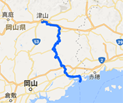
Tottori Eastern Part Route
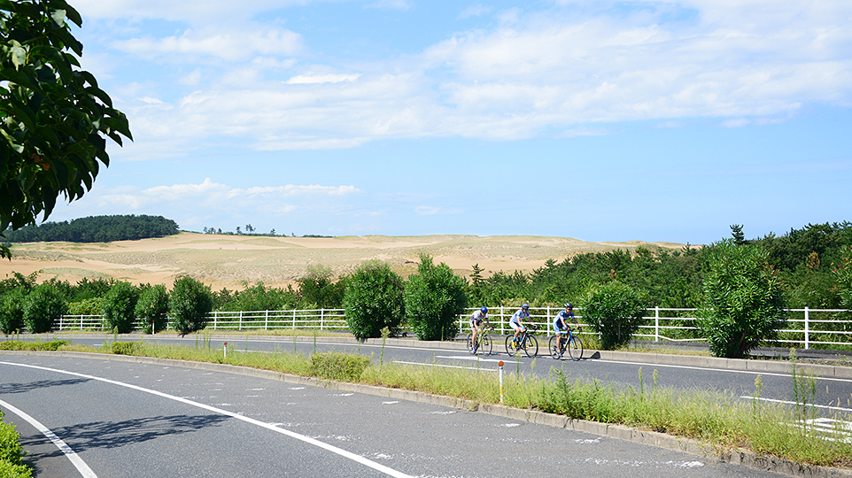
From Tottori Station to Tatsumi Mountain Path, this route follows the wonderful ever-changing scenery along the river, and is also safe and easy to ride following the opening of the Tottori Expressway. Enjoy a marvelous and refreshing sense of accomplishment as you reach the lakeshore at Ombara Kogen Highlands.
- Level
- ★★☆Middle
- Distance
- 46.95km
- Highest elevation
- 780m
- Total elevation gain
- 932m
- Average time required
- 3h
- Recommended season
- New greenery of early summer or autumn foliage seasons
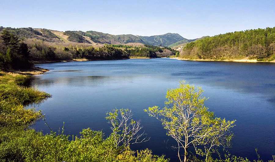
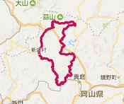
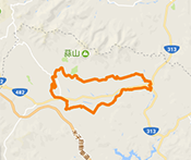
Okayama Kagamino Through Route
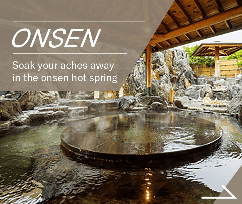
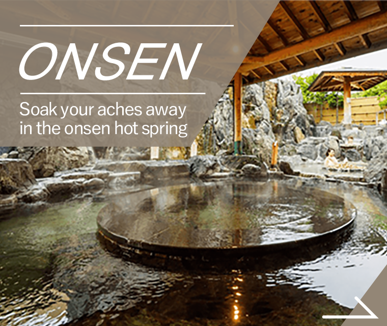
This beautiful route is distinctive for its seasonal changes. Enveloped in green and lush nature from beginning to end. There is much to see and do including roadside stations, dams, onsen hot springs, and various local gourmet specialties.
- Level
- ★★★High
- Distance
- 114km
- Highest elevation
- 791m
- Total elevation gain
- 1,729m
- Average time required
- 4h
- Recommended season
- New greenery of early summer or autumn foliage seasons
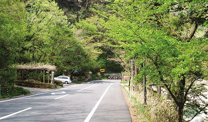
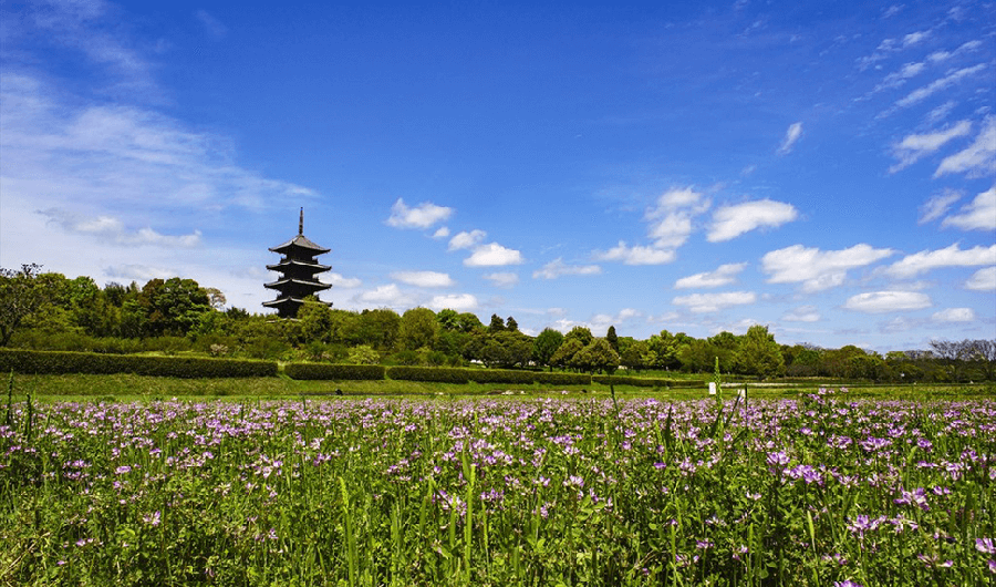
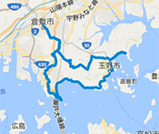
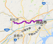
Kibiji Cycling Route
Along a gentle and largely flat road, this route links historical spots in the Kibi area, including BICCHU Kokubun-ji Temple, the Tsukuriyama-kofun burial mound, and Kibitsu-jinja Shrine. Enjoy this relaxing journey as you putter down the road surrounded with history and the beauty of the seasons.
- Level
- ★☆☆Intermediate
- Distance
- 25km
- Highest elevation
- 26m
- Total elevation gain
- 42m
- Average time required
- 1h
- Recommended season
- Spring Lotus flower season or Summer Sunflower season
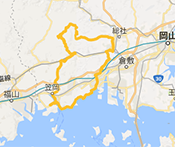
- KURASHIKI TAMANO
SEASIDE ROUTE - Level of difficulty / ★★☆ Intermediate
- Distance
- 90km
- Highest elevation
- 219m
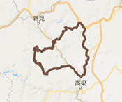
- BICCHU AROUND
HISTORICAL VISITING ROUTE - Level of difficulty / ★★☆ Intermediate

- Distance
- 108km
- Highest elevation
- 409m
- OKUKIBI
YAMABIKO ROUTE - Level of difficulty / ★★★ Advanced

- Distance
- 83km
- Highest elevation
- 451m
- MANIWA SHINJO
YAMANAMI ROUTE - Level of difficulty / ★★☆ Intermediate
- Distance
- 100km
- Highest elevation
- 539m
- KATATETSU
ROMAN KAIDOU ROUTE - Level of difficulty / ★★☆ Intermediate
- Distance
- 76km
- Highest elevation
- 125m
- OKAYAMA KAGAMINO
THROUGH ROUTE - Level of difficulty / ★★★ Advanced
- Distance
- 114km
- Highest elevation
- 791m
- KIBIJI
CYCLING ROUTE - Level of difficulty / ★☆☆ Beginner

- Distance
- 25km
- Highest elevation
- 26m
- HIRUZEN-KOGEN
HEIGHTS CYCLING ROUTE - Level of difficulty / ★☆☆ Beginner
- Distance
- 29km
- Highest elevation
- 135m
KURASHIKI TAMANO
SEASIDE ROUTE
- Level / ★★☆ Intermediate
-

- Distance
- 90km
- Highest elevation
- 219m
BICCHU AROUND
HISTORICAL VISITING ROUTE
- Level / ★★☆ Intermediate
-
- Distance
- 108km
- Highest elevation
- 409m
OKUKIBI
YAMABIKO ROUTE
- Level / ★★★ Advanced
-
- Distance
- 83km
- Highest elevation
- 451m
MANIWA SHINJO
YAMANAMI ROUTE
- Level / ★★☆ Intermediate
-

- Distance
- 100km
- Highest elevation
- 539m
KATATETSU
ROMAN KAIDOU ROUTE
- Level / ★★☆ Intermediate
-

- Distance
- 76km
- Highest elevation
- 125m
OKAYAMA KAGAMINO
THROUGH ROUTE
- Level / ★★★ Advanced
-

- Distance
- 114km
- Highest elevation
- 791m
KIBIJI
CYCLING ROUTE
- Level / ★☆☆ Beginner
-
- Distance
- 25km
- Highest elevation
- 26m
HIRUZEN-KOGEN
HEIGHTS CYCLING ROUTE
- Level / ★☆☆ Beginner
-

- Distance
- 29km
- Highest elevation
- 135m

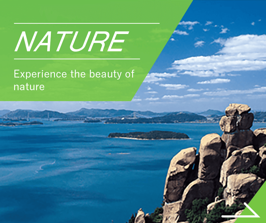
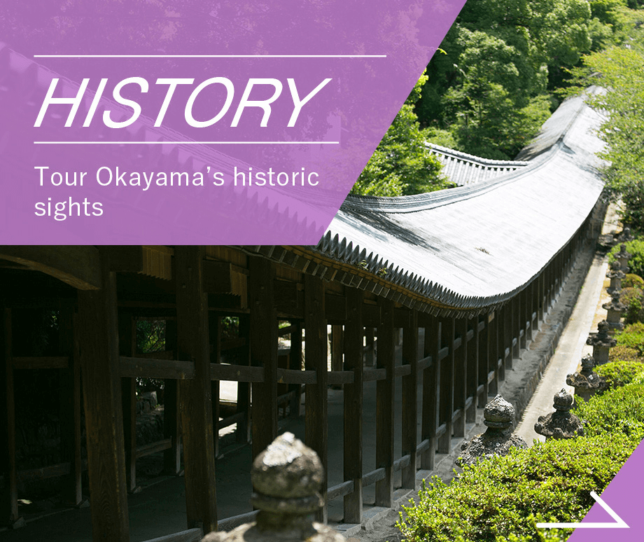
CATEGORYSearch by purpose and preference for the route you want to try


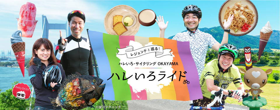
SPECIAL CONTENTS世界で活躍するサイクリストたちが、
マイバイクで岡山を走ります。


- ●Tourist-related inquiriesTourism Division, Industry and Labor Department, Okayama Prefecture TEL 086-226-7382
- ●Inquiries about the recommended cycling routesRoad Maintenance Division, Civil Engineering Department, Okayama Prefecture TEL 086-226-7472
©Hareiro Cycling Okayama, All Rights Reserved