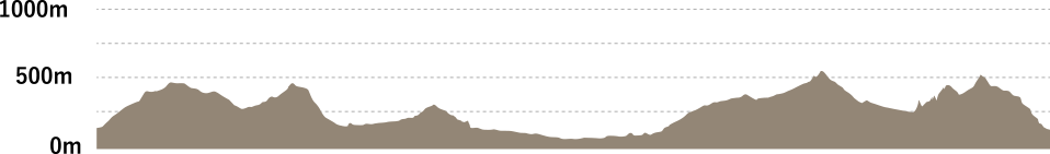
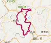
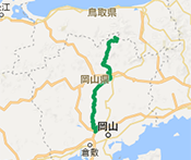
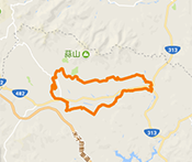
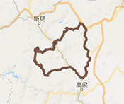
OKUKIBI YAMABIKO ROUTE
This route offers the spectacle of limestone caves and fields of seasonal flowers in the Hokubo area. The section from the Takahashi River to Fukiya is actually used in the Hill Climb Challenge Series, an annual cycling race, and involves steep inclines and declines making it only suitable for advanced cyclists.
- Level
- ★★★Advanced
- Distance
- 83km
- Highest elevation
- 451m
- Total elevation gain
- 1639m
- Average time required
- 2h30m
- Recommended season
- Autumn Autumn foliage season
A route featuring challenging sections with steep inclines and declines that are also used in the Hill Climb Challenge Series
ROUTE VIEW POINTRoute view point
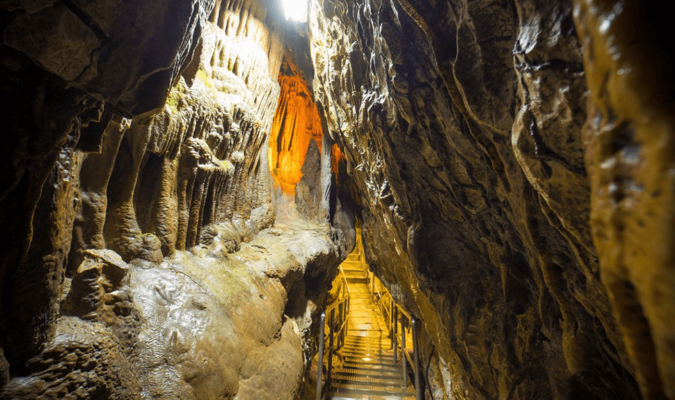
Ikurado Cave (Niimi City)
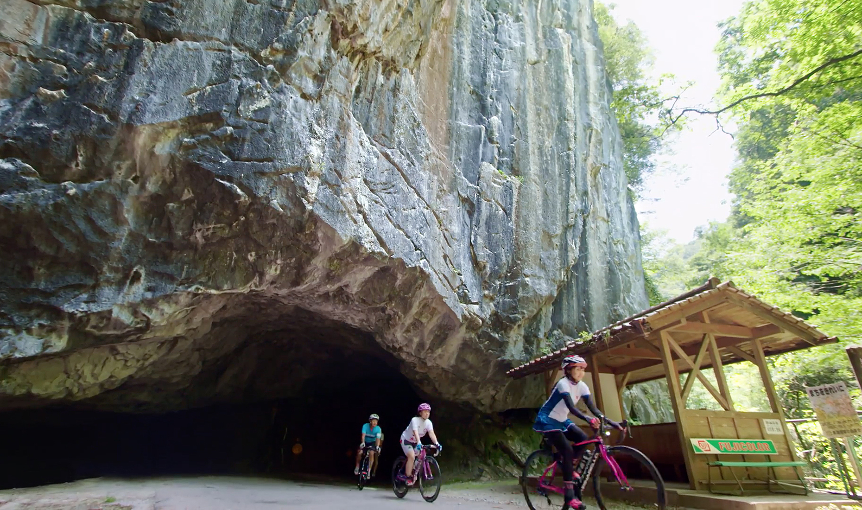
Carved out by the Takahashi River, this underground world unfolds beneath the stunningly beautiful and dynamic scenery of the Ikura Gorge. With a total length of 1,200 m, Ikurado Cave is the second largest in Western Japan, after Akiyoshido Cave, featuring height variations up to 90 m.

Makido Cave (Niimi City)
This limestone cave was one of the first in the group of limestone caves to develop in Niimi City and runs for a total length of about 450 m with an underground lake covering the rear of the cavern. The cave is also home to Japan’s best rimstone formations known as the senmaida or 1,000 rice fields.
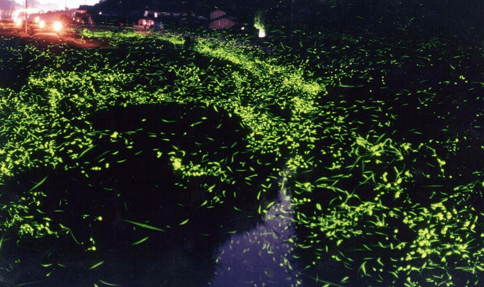
Hokubo Hotaru Park (Firefly Park) (Maniwa City)
This park on the banks of the BICCHU River is home to three species of fireflies, the Japanese firefly, the Heike-botaru firefly, and the Hime-botaru firefly.
Ukan Tsuneyama Park (Takahashi City)
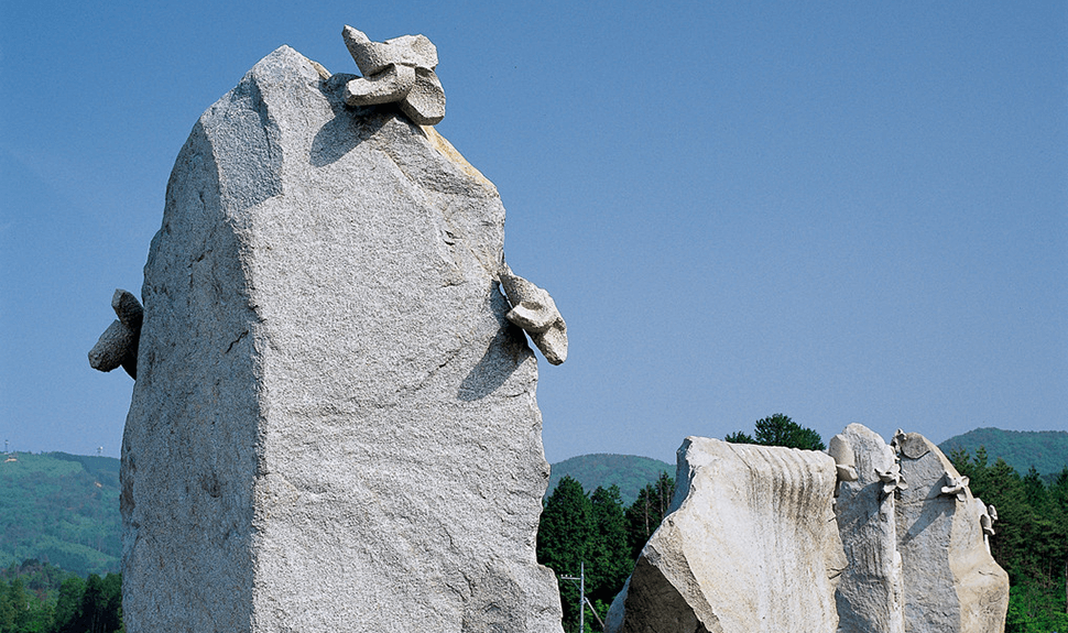
The main attraction at this park is the giant stone windmills. These seven windmills range in size of heights up to about 5.5 m, diameters up to 242 cm and weights up to 2 tons. The large lawn area around the windmills blends in and harmonizes with Mt. Ohira and Mt. Gongen in the background which enhances the view of these impressive works of art.
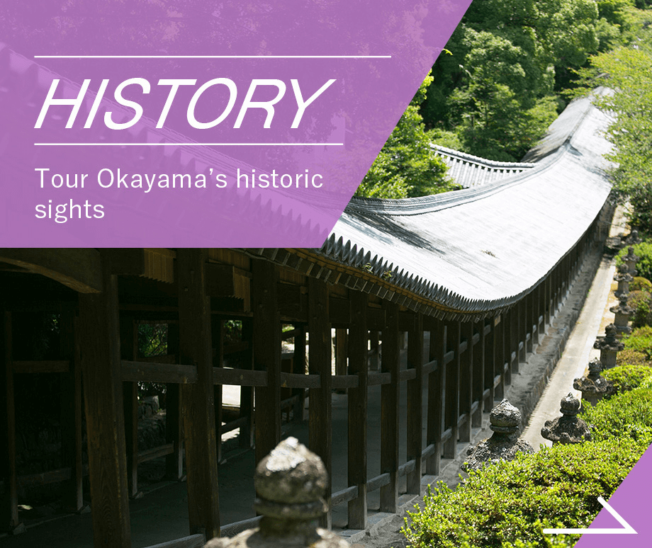
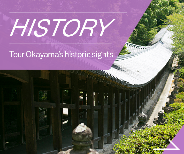
Bicchu Matsuyama Castle (Takahashi City)
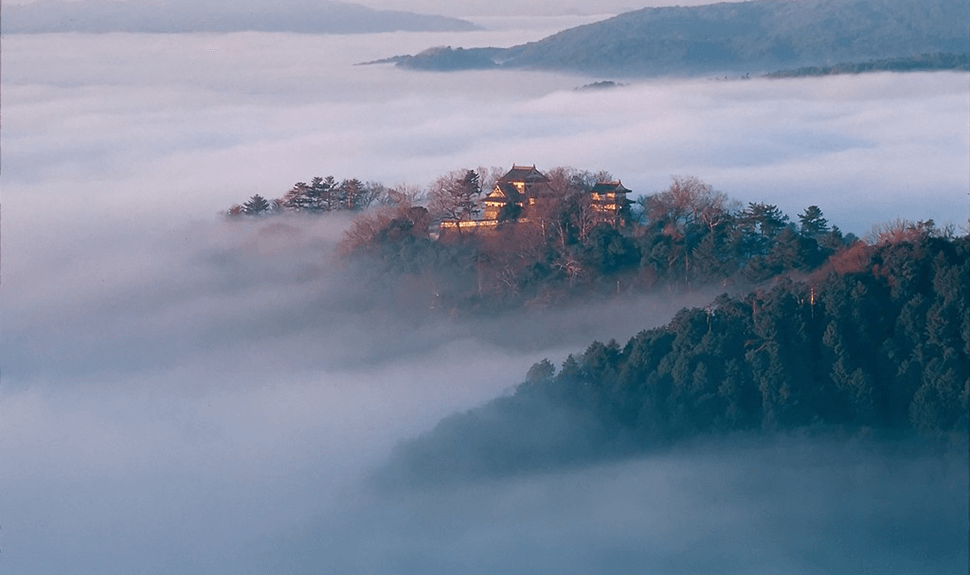
This is the last remaining mountain castle in Japan that has the main keep preserved in its original condition and is one of only 12 castles in Japan that still have their original wooden keep. Each year there are many days from autumn to early winter when low-lying clouds appear to form a sea of clouds around the castle. On these days, the castle truly appears to be a castle in the sky when viewed from the Bicchu Matsuyama Castle viewing platform.
Hayamakei Gorge (Takahashi City)
This limestone gorge runs for a total distance of about 2 km. Here you can see the natural landscape at its best, including waterfalls, limestone caves, and strange, large, misshapen rocks known as hayama-decken. The rocky scenery is further enhanced in spring by fresh new greenery, and in autumn by the burnished colors of the changing leaves.
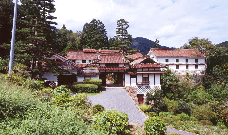
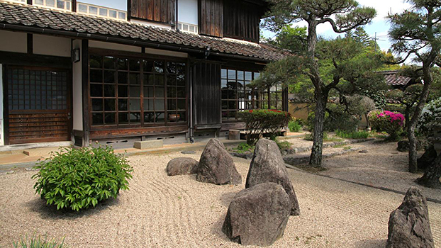
Hirokane Residence (Takahashi City)
This impressive residence was the home of the Hirokane family, who served as the head of the village of Onoro, and amassed a vast fortune from the Koizumi copper mine and production of iron sulfate in the mid-Edo period. The wealth of the family is still evident today from the imposing presence of the buildings.
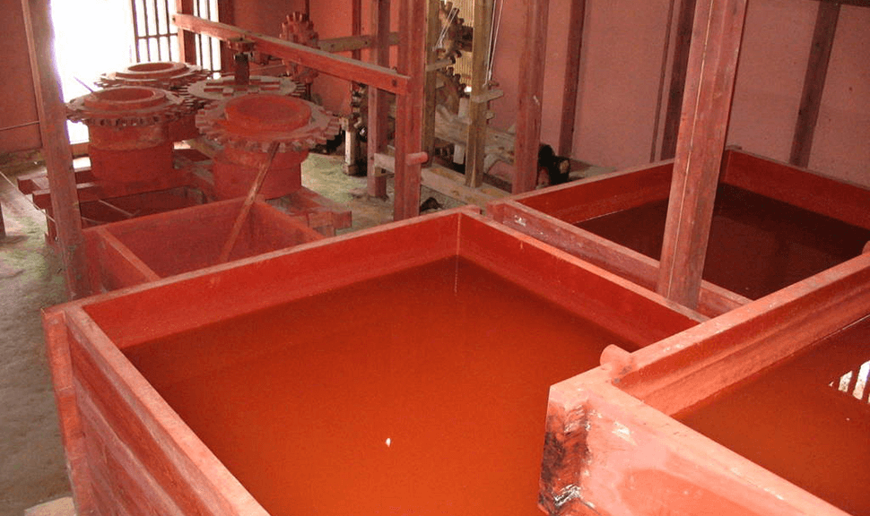
Bengara Factory Museum (Takahashi City)
Bengara is a red ocher pigment first developed in Fukiya in 1707, which became a huge industry that helped the community prosper. The Bengara Factory Museum recreates a factory from the late 19th century and displays production techniques from that time.
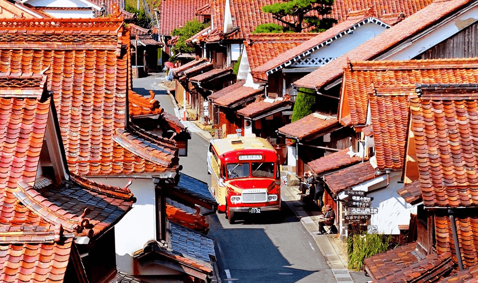
Fukiya Furusato Village (Takahashi City)
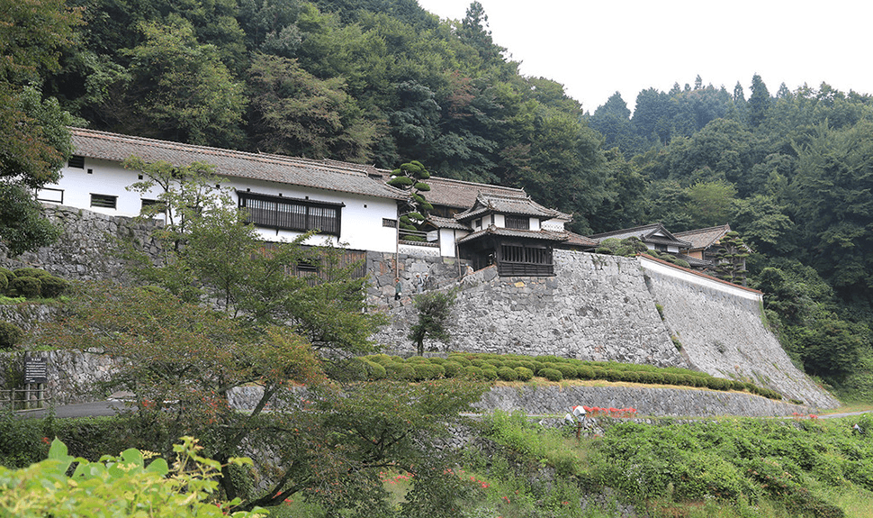
This village is a magnificent sight known for the uniform, vivid, red bengara color of its houses and the red copper color of its sekishukawara roof tiles. No individual house stands out in terms of size or appearance, but rather the entire village was built based on a concept of uniformity with master craftsmen appointed to do the work.
Nishie Residence (Takahashi City)
Members of the Nishie family served as village headmen for the shogunate during the Edo period. In addition to being the family’s residence, it was also used as the local administrator’s offices. Many of the buildings are still preserved in their original state including storehouses, stables, a school room, a magistrate’s room, and houses used for government officials.
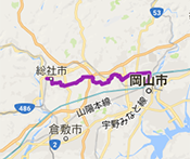
ACCESSAccess to start and finish point(s)
- ●Via car:
- Approx. 20 minutes from the Niimi IC on the Chugoku Expressway, or approx. 40 minutes from the Kayo IC on the Okayama Expressway
- ●Via train:
- From JR Okayama Station
Approx. 90 minutes to JR Ikura Station, get off at JR Ikura Station, then approx. 15 minutes walk
PARKING SPACEParking lots around the start and along the route
Parking
-
- Takakura Regional Civic Center
- 4532-2 Tai, Takakura-cho, Takahashi City 719-2122
-
- Fukiya Furusato Village
- Fukiya, Nariwa-cho, Takahashi City 719-2341
- Parking lot: Approx. 100 cars, 5 buses
-
- Ikurado Cave▲Near the start and finish point(s)
- 409 Ikura, Niimi City 719-2551
- Parking lot: Approx. 250 cars, 20 buses (free)
HOTELRecommended hotels for cyclists
-
Takahashi International Hotel
- Address
- 2033 Masamune-cho, Takahashi City 716-0037
- TEL
- 0866-21-0080
- HP
- Hotel Website
-
Former Nakata Residence Kurayashiki Hotel
- Address
- 1757 Uji, Uji-cho, Takahashi City 719-2232
- TEL
- 0866-29-2118
- HP
- Hotel Website
- KURASHIKI TAMANO
SEASIDE ROUTE - Level of difficulty / ★★☆ Intermediate
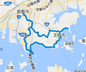
- Distance
- 90km
- Highest elevation
- 219m
- BICCHU AROUND
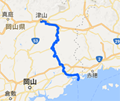
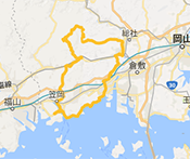
HISTORICAL VISITING ROUTE - Level of difficulty / ★★☆ Intermediate

- Distance
- 108km
- Highest elevation
- 409m
- OKUKIBI
YAMABIKO ROUTE - Level of difficulty / ★★★ Advanced

- Distance
- 83km
- Highest elevation
- 451m
- MANIWA SHINJO
YAMANAMI ROUTE - Level of difficulty / ★★☆ Intermediate
- Distance
- 100km
- Highest elevation
- 539m
- KATATETSU
ROMAN KAIDOU ROUTE - Level of difficulty / ★★☆ Intermediate
- Distance
- 76km
- Highest elevation
- 125m
- OKAYAMA KAGAMINO
THROUGH ROUTE - Level of difficulty / ★★★ Advanced
- Distance
- 114km
- Highest elevation
- 791m
- KIBIJI
CYCLING ROUTE - Level of difficulty / ★☆☆ Beginner

- Distance
- 25km
- Highest elevation
- 26m
- HIRUZEN-KOGEN
HEIGHTS CYCLING ROUTE - Level of difficulty / ★☆☆ Beginner
- Distance
- 29km
- Highest elevation
- 135m
KURASHIKI TAMANO
SEASIDE ROUTE
- Level / ★★☆ Intermediate
-

- Distance
- 90km
- Highest elevation
- 219m
BICCHU AROUND
HISTORICAL VISITING ROUTE
- Level / ★★☆ Intermediate
-
- Distance
- 108km
- Highest elevation
- 409m
OKUKIBI
YAMABIKO ROUTE
- Level / ★★★ Advanced
-
- Distance
- 83km
- Highest elevation
- 451m
MANIWA SHINJO
YAMANAMI ROUTE
- Level / ★★☆ Intermediate
-

- Distance
- 100km
- Highest elevation
- 539m
KATATETSU
ROMAN KAIDOU ROUTE
- Level / ★★☆ Intermediate
-

- Distance
- 76km
- Highest elevation
- 125m
OKAYAMA KAGAMINO
THROUGH ROUTE
- Level / ★★★ Advanced
-

- Distance
- 114km
- Highest elevation
- 791m
KIBIJI
CYCLING ROUTE
- Level / ★☆☆ Beginner
-
- Distance
- 25km
- Highest elevation
- 26m
HIRUZEN-KOGEN
HEIGHTS CYCLING ROUTE
- Level / ★☆☆ Beginner
-

- Distance
- 29km
- Highest elevation
- 135m

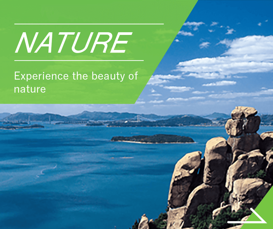
CATEGORYSearch by purpose and preference for the route you want to try


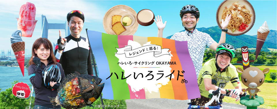
SPECIAL CONTENTS世界で活躍するサイクリストたちが、
マイバイクで岡山を走ります。


- ●Tourist-related inquiriesTourism Division, Industry and Labor Department, Okayama Prefecture TEL 086-226-7382
- ●Inquiries about the recommended cycling routesRoad Maintenance Division, Civil Engineering Department, Okayama Prefecture TEL 086-226-7472
©Hareiro Cycling Okayama, All Rights Reserved