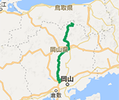
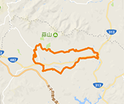
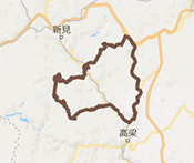
KIBIJI CYCLING ROUTE
Along a gentle and largely flat road, this route links historical spots in the Kibi area, including BICCHU Kokubun-ji Temple, the Tsukuriyama-kofun burial mound, and Kibitsu-jinja Shrine. Enjoy this relaxing journey as you putter down the road surrounded with history and the beauty of the seasons.
- Level
- ★☆☆Beginner
- Distance
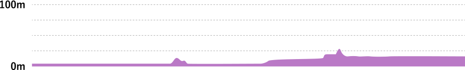
- 25km
- Highest elevation
- 26m
- Total elevation gain
- 42m
- Average time required
- 1h
- Recommended season
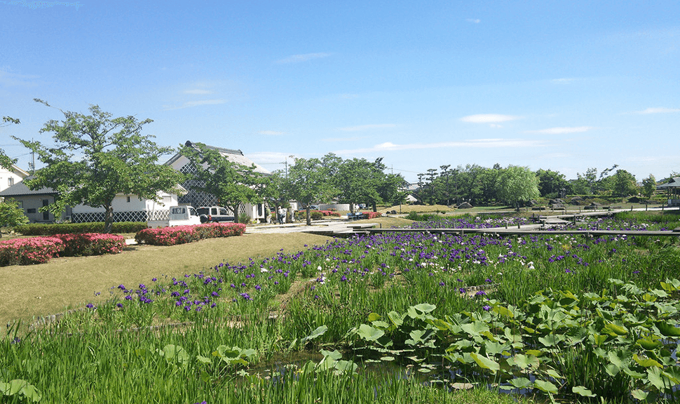
- Spring Lotus flower season or Summer Sunflower season
Visitors can enjoy the unique charm of each season on a relaxing ride from one historic spot to another.
ROUTE VIEW POINTRoute view point
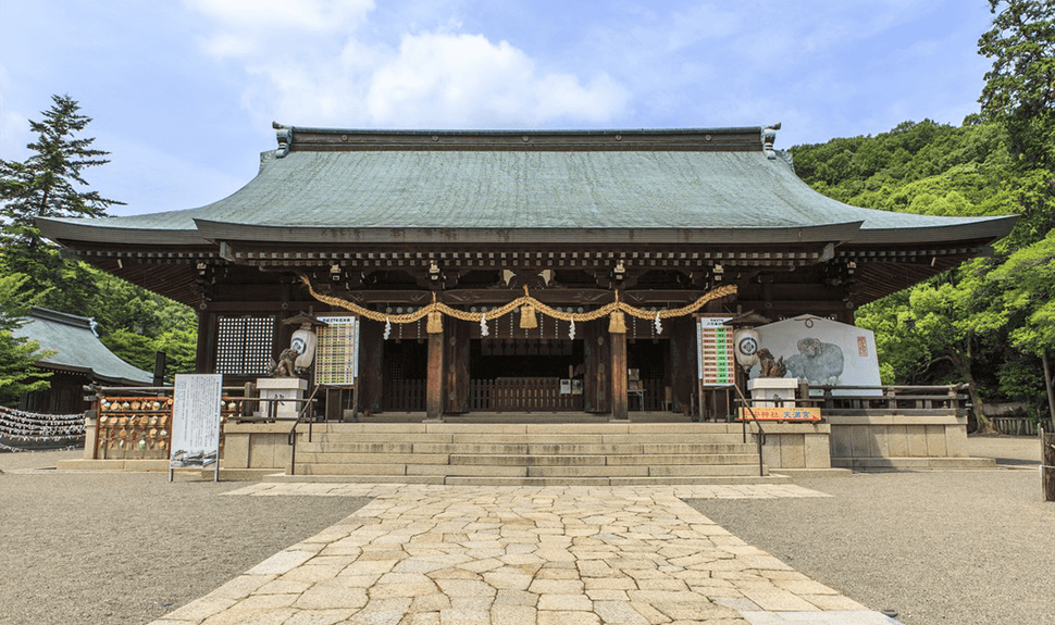
Kibitsuhiko-jinja Shrine (Okayama City)
This shrine worships Kibitsuhiko-no-Mikoto, a legendary Japanese prince who was said to have been dispatched by the Imperial Court to subjugate Kibi Province. It is said the shrine was built on the site where Mikoto’s house once stood. During the Edo period, under the patronage of the Ikeda family who ruled the Okayama Domain, the shrine was granted more land and the main shrine building was rebuilt.
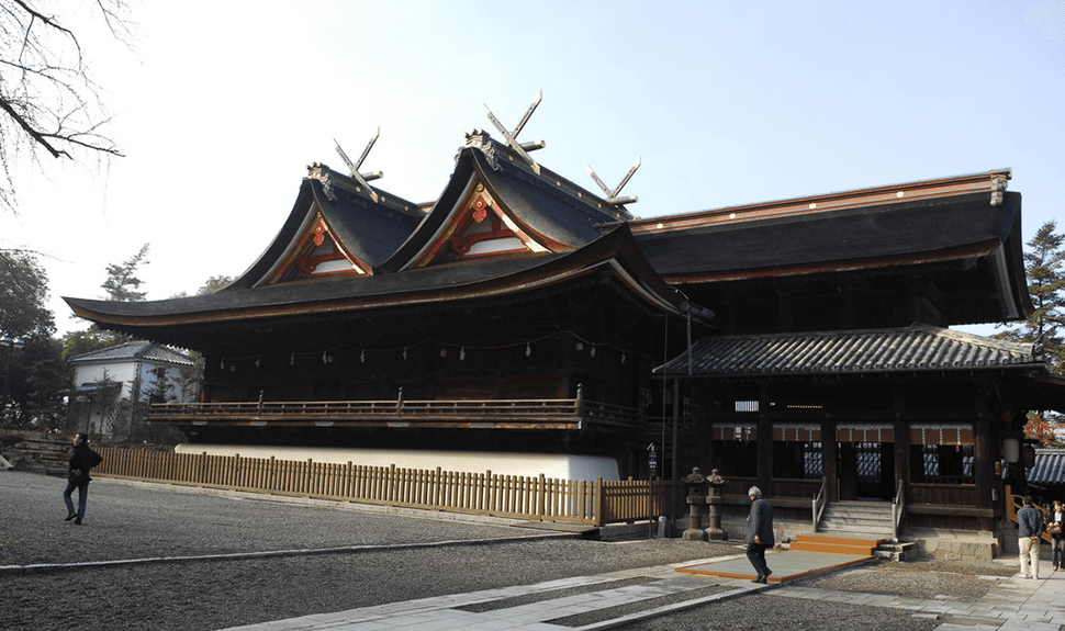
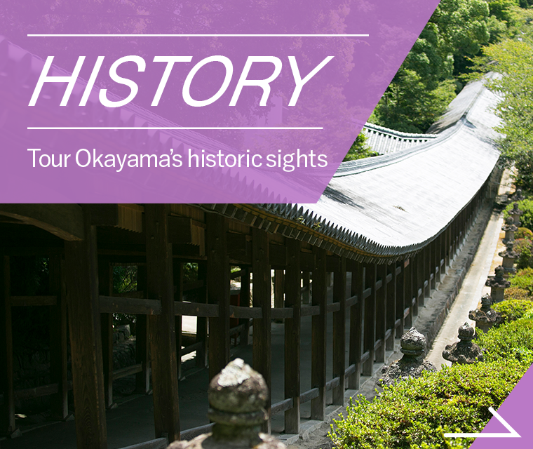
Kibitsu-jinja Shrine (Okayama City)
The main shrine building here is designated a national treasure and is the only example of its kind anywhere in Japan that is built in a style known as hiyokuirimoya-zukuri. The shrine has a rich collection of legends associated with Prince Kibitsuhiko-no-Mikoto and the ogre Ura. These include the rock where the prince loaded his arrow to shoot Ura and the clay oven where Ura’s head was said to have been buried.
Bicchu Takamatsu Castle Park (Okayama City)
Bicchu Takamatsu Castle was a strategic point on the old Matsuyama Highway that linked the domain of Bizen with BICCHU Matsuyama. It is famous as the site of the Siege of Takamatsu of 1582.
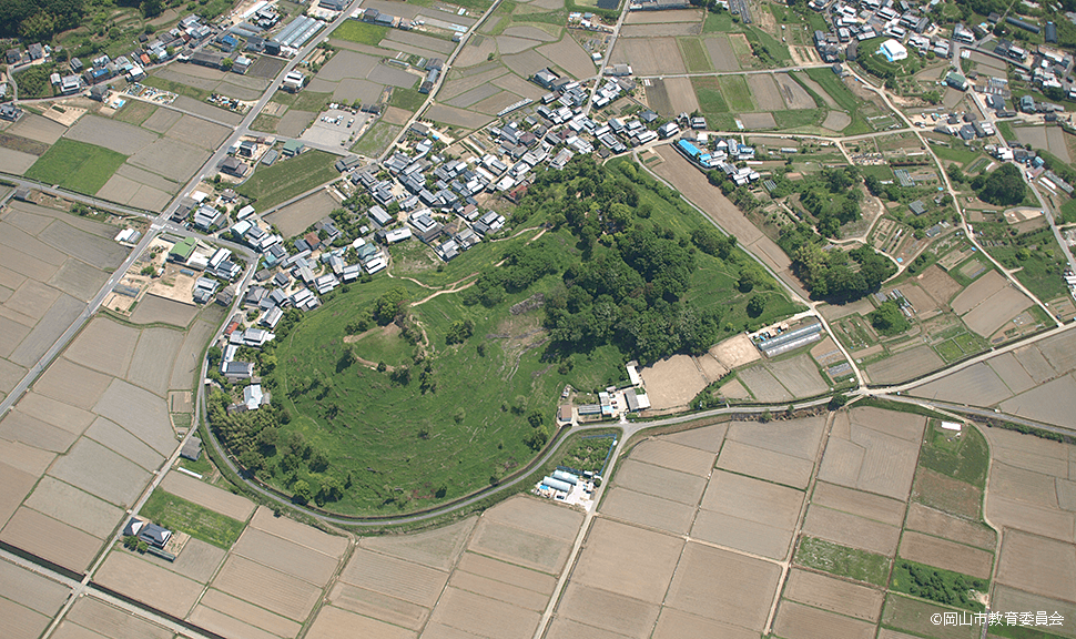
Tsukuriyama-kofun Burial Mound (Okayama City)
This keyhole-shaped burial mound is the largest in the country where visitors are able to climb to the top. There are six smaller tombs, known as baizuka, at the site including the famous Sakakiyama-kofun where horse-shaped belt hooks were found, and the Senzoku-kofun where a stone slab engraved with chokkomon (patterns of straight lines and arcs) was found.
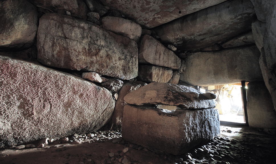
Komorizuka-kofun Burial Mound (Soja City)
This keyhole-shaped burial mound is thought to be the grave of the chief of Kibi and at the circular end is a horizontal hole-style burial chamber that has been made by piecing together enormous stones and has a total length of 19.4 m, making it one of Okayama Prefecture’s three largest megalith burial mounds.
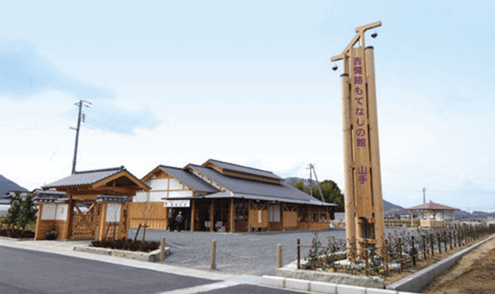
Kibiji Motenashi-no-Yakata (Soja City)
This facility looks out over the five-storied pagoda of Kokubun-ji Temple and has a hall and pavilion where visitors can eat, buy souvenirs, or view the gallery where exhibits change weekly. There is also a stall selling local specialty products and freshly picked vegetables.
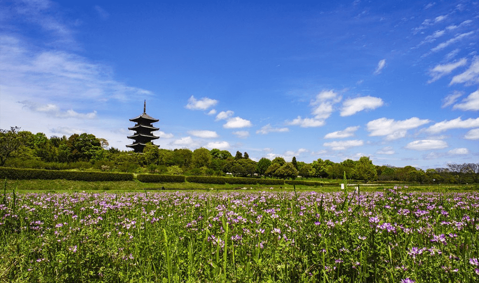
Bicchu Kokubun-ji Temple (Soja City)
This temple is one of several temples established by the order of Emperor Shomu in the Nara period (8th century). The towering five-storied pagoda in the temple precinct is the only one of its kind in Okayama Prefecture and is a symbol of Kibiji. Visitors can also enjoy the sight of sunflowers and cosmos flowers not far from the temple.
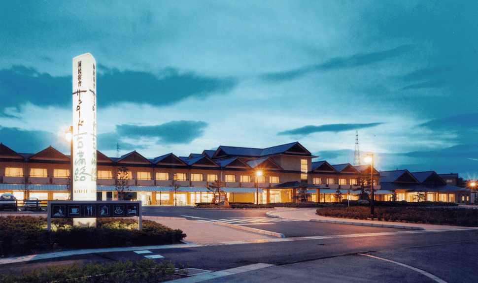
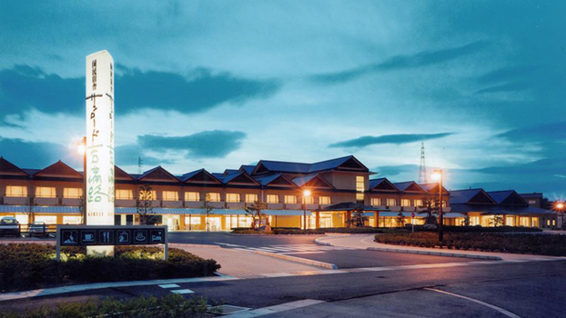
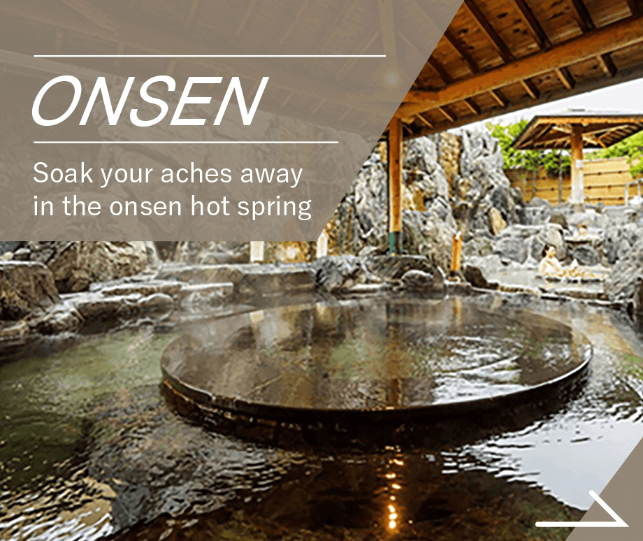
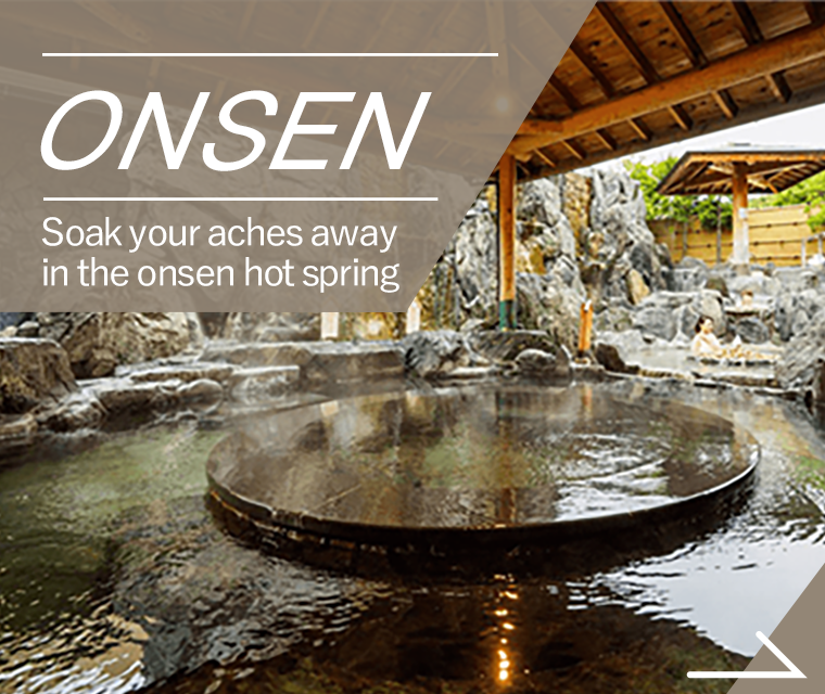
People’s Lodge Sunroad Kibiji (Soja City)
The hot spring here contains sulfur compounds and is famous for its beautifying properties, leaving skin smooth and supple. Day guests are also welcome. Why not stop by for a warming soak leaving your skin radiant?
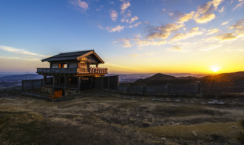
Mt. Kino-jo (Kino-jo Castle) (Soja City)
This ancient mountain castle site at an altitude of approximately 400 m on the summit of Mt. Kino-jo includes approximately 2.8 km of stone walls and earthwork. Kino-jo Castle is known as the setting for the Ura legend, which is said to be the original story relating to the famous folk tale Momotaro.
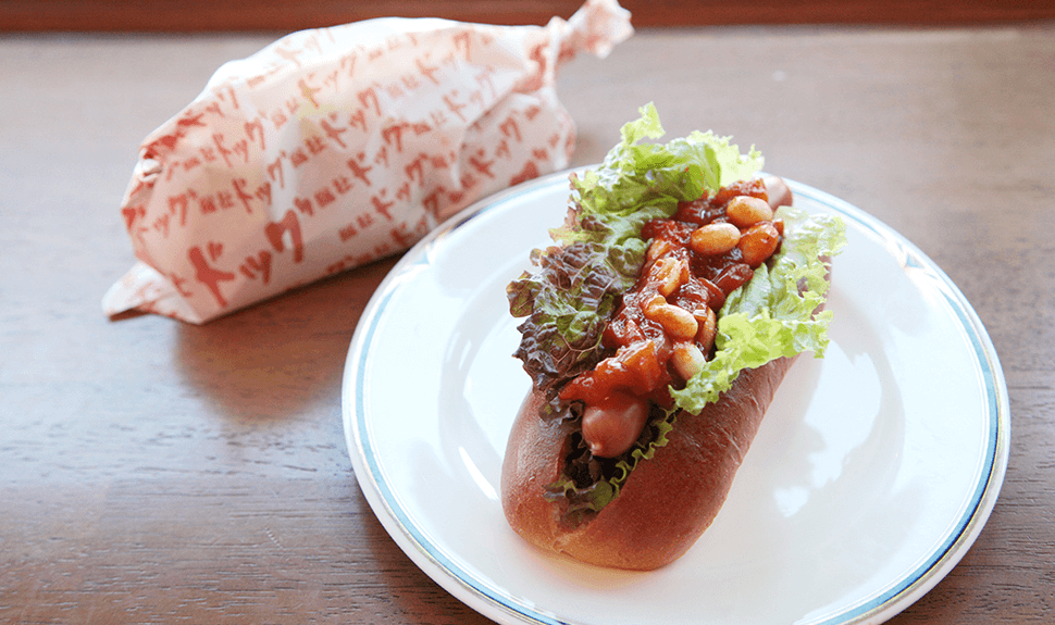
So-Ja!pan
The Soja area is the top baking region in Okayama Prefecture.There are many specialties to try, including Soja dog, fruit choux buns, and ice cream with specialty bread!
PARKING SPACEParking lots around the start and along the route
Parking
-
- Okayama Pref. Multipurpose Grounds▲スタート地点付近
- 2-1 Izumicho, Kita-ku, Okayama City 700-0012
- Parking lot: Parking lot no. 1 approx. 140 cars, parking lot no. 2 approx. 132 cars, parking lot no. 3 approx. 94 cars (paid)
-
- Bicchu Kokubun-ji Temple
- 1046 Kanbayashi, Soja City 719-1123
- Parking lot: Approx. 200 cars, 15 buses
-
- Ashimori Plaza
- 979 Ashimori, Kita-ku, Okayama City 701-1463
- Parking lot: Approx. 17 cars, 1 bus, EV charging stand (1 charger with cable) (free)
-
- Soja Municipal Soja Station North Parking Lot▲ゴール地点付近
- 1-1-3 Ekimae, Soja City 719-1136
- Parking lot: 77 cars
HOTELRecommended hotels for cyclists
-
People’s Lodges Sunroad Kibiji
- Address
- 825-1 Misu, Soja City 719-1124
- TEL
- 0866-90-0550
- HP
- Hotel Website
- KURASHIKI TAMANO
SEASIDE ROUTE - Level of difficulty / ★★☆ Intermediate
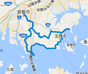
- Distance
- 90km
- Highest elevation
- 219m
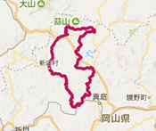
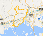
- BICCHU AROUND
HISTORICAL VISITING ROUTE - Level of difficulty / ★★☆ Intermediate

- Distance
- 108km
- Highest elevation
- 409m
- OKUKIBI
YAMABIKO ROUTE - Level of difficulty / ★★★ Advanced

- Distance
- 83km
- Highest elevation
- 451m
- MANIWA SHINJO
YAMANAMI ROUTE - Level of difficulty / ★★☆ Intermediate
- Distance
- 100km
- Highest elevation
- 539m
- KATATETSU
ROMAN KAIDOU ROUTE - Level of difficulty / ★★☆ Intermediate
- Distance
- 76km
- Highest elevation
- 125m
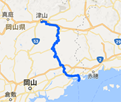
- OKAYAMA KAGAMINO
THROUGH ROUTE - Level of difficulty / ★★★ Advanced
- Distance
- 114km
- Highest elevation
- 791m
- KIBIJI
CYCLING ROUTE - Level of difficulty / ★☆☆ Beginner

- Distance
- 25km
- Highest elevation
- 26m
- HIRUZEN-KOGEN
HEIGHTS CYCLING ROUTE - Level of difficulty / ★☆☆ Beginner
- Distance
- 29km
- Highest elevation
- 135m
KURASHIKI TAMANO
SEASIDE ROUTE
- Level / ★★☆ Intermediate
-

- Distance
- 90km
- Highest elevation
- 219m
BICCHU AROUND
HISTORICAL VISITING ROUTE
- Level / ★★☆ Intermediate
-
- Distance
- 108km
- Highest elevation
- 409m
OKUKIBI
YAMABIKO ROUTE
- Level / ★★★ Advanced
-
- Distance
- 83km
- Highest elevation
- 451m
MANIWA SHINJO
YAMANAMI ROUTE
- Level / ★★☆ Intermediate
-

- Distance
- 100km
- Highest elevation
- 539m
KATATETSU
ROMAN KAIDOU ROUTE
- Level / ★★☆ Intermediate
-

- Distance
- 76km
- Highest elevation
- 125m
OKAYAMA KAGAMINO
THROUGH ROUTE
- Level / ★★★ Advanced
-

- Distance
- 114km
- Highest elevation
- 791m
KIBIJI
CYCLING ROUTE
- Level / ★☆☆ Beginner
-
- Distance
- 25km
- Highest elevation
- 26m
HIRUZEN-KOGEN
HEIGHTS CYCLING ROUTE
- Level / ★☆☆ Beginner
-

- Distance
- 29km
- Highest elevation
- 135m
CATEGORYSearch by purpose and preference for the route you want to try


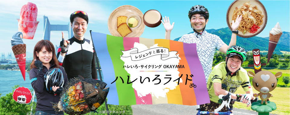
SPECIAL CONTENTS世界で活躍するサイクリストたちが、
マイバイクで岡山を走ります。


- ●Tourist-related inquiriesTourism Division, Industry and Labor Department, Okayama Prefecture TEL 086-226-7382
- ●Inquiries about the recommended cycling routesRoad Maintenance Division, Civil Engineering Department, Okayama Prefecture TEL 086-226-7472
©Hareiro Cycling Okayama, All Rights Reserved